National Geospatial-intelligence Agency - Загрузки
|
Результатов поиска: 53 (max: 500)
|
| Тема | Автор | Размер | S | |||||||
|---|---|---|---|---|---|---|---|---|---|---|
|
US Pub. 147 Sailing Directions (Enroute) Caribbean Sea Volume I - National Geospatial-Intelligence Agency [2022, PDF]
Author: National Geospatial-Intelligence Agency |
twicer | 4968307 5 MB | 2 | |||||||
|
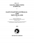
US Pub. 127 Sailing Directions (Enroute) East Coast of Australia and New Zealand - National Geospatial Intelligence Agency [2022, PDF]
Author: National Geospatial Intelligence Agency |
twicer | 7710146 7 MB | 1 | |||||||
|
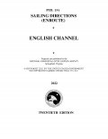
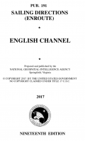
US Pub. 191 Sailing Directions (Enroute) English Channel - National Geospatial Intelligence Agency [2022, PDF]
Author: National Geospatial Intelligence Agency |
twicer | 8729599 8 MB | 1 | |||||||
|
US Pub. 154 Sailing Directions (Enroute) British Columbia - National Geospatial Intelligence Agency [2022, PDF]
Author: National Geospatial Intelligence Agency |
twicer | 10520206 10 MB | 1 | |||||||
|
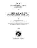
US Pub. 142 Sailing Directions (Enroute) Ireland and the West Coast of England - National Geospatial Intelligence Agency [2022, PDF]
Author: National Geospatial Intelligence Agency |
twicer | 3848533 4 MB | 0 | |||||||
|
US Pub. 175 Sailing Directions (Enroute) North, West, and South Coasts of Australia - National Geospatial Intelligence Agency [2022, PDF]
Author: National Geospatial Intelligence Agency |
twicer | 4389002 4 MB | 0 | |||||||
|
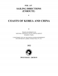
US Pub. 157 Sailing Directions (Enroute) Coasts of Korea and China - National Geospatial Intelligence Agency [2022, PDF]
Author: National Geospatial Intelligence Agency |
twicer | 5543663 5 MB | 0 | |||||||
|
US Pub. 143 Sailing Directions (Enroute) West Coast of Europe and Northwest Africa - National Geospatial Intelligence Agency [2022, PDF]
Author: National Geospatial Intelligence Agency |
twicer | 15270807 15 MB | 0 | |||||||
|
US Pub. 148 Sailing Directions (Enroute) Caribbean Sea Volume II - National Geospatial-Intelligence Agenc [2022, PDF]
Author: National Geospatial-Intelligence Agency |
twicer | 4921007 5 MB | 3 | |||||||
|
US Pub. 131 Sailing Directions (Enroute) Western Mediterranean - National Geospatial-Intelligence Agency [2022, PDF]
Author: National Geospatial-Intelligence Agency |
twicer | 14084047 13 MB | 1 | |||||||
|
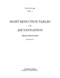
SIGHT REDUCTION TABLES FOR AIR NAVIGATION - (SELECTED STARS) - EPOCH 2020 - National Geospatial Intelligence Agency [2016, PDF]
Author: National Geospatial Intelligence Agency |
pierdolphin1… | 50719365 48 MB | 0 | |||||||
|
Pub. 127 Sailing Directions (Enroute) ★ East Coast Of Australia And New Zealand - National Geospatial-Intelligence Agency [2017, PDF]
Author: National Geospatial-Intelligence Agency |
Ferreirolo | 7686776 7 MB | 3 | |||||||
|
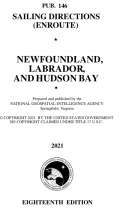
Pub. 146 Sailing Directions (Enroute) ★ Newfoundl And, Labrador, And Hudson Bay - national Geospatial-Intelligence Agency [2021, PDF]
Author: national Geospatial-Intelligence Agency |
Ferreirolo | 9650671 9 MB | 2 | |||||||
|
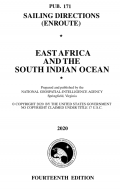
Pub. 171 Sailing Directions (Enroute) ★ East Africa And The South Indian Ocean - National Geospatial-Intelligence Agency [2020, PDF]
Author: National Geospatial-Intelligence Agency |
Ferreirolo | 4357341 4 MB | 4 | |||||||
|
Pub. 180 Sailing Directions (Planning Guide) ★ Arctic Ocean - National Geospatial-Intelligence Agency [2020, PDF]
Author: National Geospatial-Intelligence Agency |
Ferreirolo | 7549753 7 MB | 2 | |||||||
|
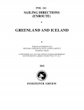
Pub. 181 Sailing Directions (Enroute) Greenland and Iceland - National Geospatial-Intelligence Agency [2021, PDF]
Author: National Geospatial-Intelligence Agency |
twicer | 4341770 4 MB | 2 | |||||||
|
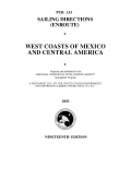
Pub. 153 Sailing Directions (Enroute) West Coasts of Mexicoand Central America - National Geospatial-Intelligence Agency [2021, PDF]
Author: National Geospatial-Intelligence Agency |
twicer | 7158399 7 MB | 2 | |||||||
|
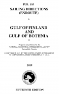
Pub. 195 Sailing Directions (Enroute) Gulf of Finland and Gulf of Bothnia - National Geospatial-Intelligence Agency [2021, PDF]
Author: National Geospatial-Intelligence Agency |
twicer | 5737961 5 MB | 2 | |||||||
|
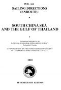
Pub. 161 Sailing Directions (Enroute) ★ South China Sea And The Gulf Of Thailand (7 August 2021) - National Geospatial-Intelligence Agency [2021, PDF]
Author: National Geospatial-Intelligence Agency |
Ferreirolo | 4967426 5 MB | 4 | |||||||
|
Pub. 157 Sailing Directions (Enroute) ★ Coasts Of Korea And China (14 August 2021) - National Geospatial-Intelligence Agency [2021, PDF]
Author: National Geospatial-Intelligence Agency |
Ferreirolo | 5550040 5 MB | 3 | |||||||
|
Pub. 155 Sailing Directions (Enroute) ★ East Coast Of Russia (15 May 2021) - National Geospatial-Intelligence Agency [2021, PDF]
Author: National Geospatial-Intelligence Agency |
Ferreirolo | 5020548 5 MB | 3 | |||||||
|
Pub. 183 Sailing Directions (Enroute) ★ North Coast Of Russia - National Geospatial-Intelligence Agency [2021, PDF]
Author: National Geospatial-Intelligence Agency |
Ferreirolo | 4501042 4 MB | 3 | |||||||
|
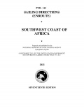
Pub. 123 Sailing Directions (Enroute) Southwest Coast Of Africa - National Geospatial-Intelligence Agency [2021, PDF]
Author: National Geospatial-Intelligence Agency |
twicer | 3180192 3 MB | 3 | |||||||
|
US Pilot Charts the World Collection - National Geospatial-Intelligence Agency [201?, PDF]
Author: National Geospatial-Intelligence Agency |
twicer | 492477174 470 MB | 1 | |||||||
|
US Sailing Directions (Enroute) the World Collection - National Geospatial-Intelligence Agency [Vary, PDF]
Author: National Geospatial-Intelligence Agency |
twicer | 305237850 291 MB | 6 | |||||||
|
International Code of Signals US Edition (Pub. 102) - National Geospatial-Intelligence Agency [2020, PDF]
Author: National Geospatial-Intelligence Agency |
paolina_3 | 2614568 2 MB | 3 | |||||||
|
Pub. 195 Sailing Directions (Enroute) Gulf Of Finland And Gulf Of Bothnia (30 January 2021) - National Geospatial-Intelligence Agency [2021, PDF]
Author: National Geospatial-Intelligence Agency |
Ferreirolo | 5767059 5 MB | 0 | |||||||
|
Pub. 155 Sailing Directions (Enroute) East Coast Of Russia (14 November 2020) - National Geospatial-Intelligence Agency [2020, PDF]
Author: National Geospatial-Intelligence Agency |
Ferreirolo | 5028072 5 MB | 1 | |||||||
|
Pub. 123 Sailing Directions (Enroute) Southwest Coast Of Africa (30 January 2021) - National Geospatial-Intelligence Agency [2021, PDF]
Author: National Geospatial-Intelligence Agency |
Ferreirolo | 3221803 3 MB | 2 | |||||||
|
Pub. 126 Sailing Directions (Enroute). Pacific Islands (23 January 2021) - National Geospatial-Intelligence Agency [2021, PDF]
Author: National Geospatial-Intelligence Agency |
Ferreirolo | 9276444 9 MB | 3 | |||||||
|
Pub. 191 Sailing Directions (Enroute). English Channel (9 January 2021) - National Geospatial-Intelligence Agency [2021, PDF]
Author: National Geospatial-Intelligence Agency |
Ferreirolo | 8739358 8 MB | 2 | |||||||
|
Pub.110 List of Lights, Radio Aids and Fog Signals for Greenland, the East Coasts of North and South America (excluding Continental USA except the East Coast of Florida), and the West Indies - National Geospatial-intelligence Agency [2019, PDF]
Author: National Geospatial-intelligence Agency |
Vitbar192 | 2387445 2 MB | 1 | |||||||
|
Pub.111 List of Lights, Radio Aids and Fog Signals for the West Coasts of North and South America (excluding Continental U.S.A. and Hawaii), Australia, Tasmania, New Zealand and the Islands of the North and South Pacific Oceans - National Geospatial-
Author: National Geospatial-intelligence Agency |
Vitbar192 | 2634399 3 MB | 0 | |||||||
|
Pub.112 List of Lights, Radio Aids and Fog Signals for the Western Pacific and Indian Oceans including the Persian Gulf and Red Sea - National Geospatial-intelligence Agency [2019, PDF]
Author: National Geospatial-intelligence Agency |
Vitbar192 | 4066574 4 MB | 1 | |||||||
|
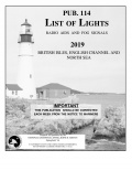
Pub.114 List of Lights, Radio Aids and Fog Signals for the British Isles, English Channel and North Sea - National Geospatial-intelligence Agency [2019, PDF]
Author: National Geospatial-intelligence Agency |
Vitbar192 | 4326688 4 MB | 1 | |||||||
|
Pub.115 List of Lights, Radio Aids and Fog Signals for Norway, Iceland and the Arctic Ocean - National Geospatial-intelligence Agency [2019, PDF]
Author: National Geospatial-intelligence Agency |
Vitbar192 | 4326688 4 MB | 1 | |||||||
|
Pub.116 List of Lights, Radio Aids and Fog Signals for Baltic Sea with Kattegat, Belts and Sound and Gulf of Bothnia, - National Geospatial-intelligence Agency [2019, PDF]
Author: National Geospatial-intelligence Agency |
Vitbar192 | 2290704 2 MB | 1 | |||||||
|
Pub.113 List of Lights, Radio Aids and Fog Signals for the West Coasts of Europe and Africa, the Mediterranean Sea, Black Sea and Azovskoye More - National Geospatial-intelligence Agency [2019, PDF]
Author: National Geospatial-intelligence Agency |
Vitbar192 | 3337754 3 MB | 2 | |||||||
|
Pub.145 Sailing directions (Enroute). Nova Scotia and the St.Lawrence - National Geospatial-Intelligence Agency [2018, PDF]
Author: National Geospatial-Intelligence Agency |
Vitbar192 | 7114350 7 MB | 2 | |||||||
|
Pub.148 Sailing directions (Enroute). Caribean Sea. Vol. II - National Geospatial-intelligence Agency [2017, PDF]
Author: National Geospatial-intelligence Agency |
Vitbar192 | 4873717 5 MB | 1 | |||||||
|
Pub.147 Sailing Directions (Enroute). Caribean Sea. Vol. I - National Geospatial-intelligence Agency [2018, PDF]
Author: National Geospatial-intelligence Agency |
Vitbar192 | 4928165 5 MB | 3 | |||||||
|
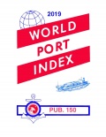
World Port Index 2019 (Pub. 150) - National Geospatial Intelligence Agency [2019, PDF]
Author: National Geospatial Intelligence Agency |
marlamamba | 4466046 4 MB | 1 | |||||||
|
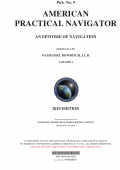
The American Practical Navigator (Pub. Nº9) volume 1 - Nathaniel Bowdicht (Dr. Gerard J. Clifford, Jr. editor) [2019, PDF]
Author: Nathaniel Bowdicht (Dr. Gerard J. Clifford, Jr. editor) |
Ferreirolo | 36943699 35 MB | 1 | |||||||
|
U.S. Chart No. 1 - Symbols, Abbreviations and Terms used on Paper and Electronic Navigational Charts - National Oceanic and Atmospheric Administration, National Geospatial-Intelligence Agency [2019, PDF]
Author: National Oceanic and Atmospheric Administration, National Geospatial-Intelligence Agency |
NNT | 114505150 109 MB | 4 | |||||||
|
Sight Reduction Table for Air Navigation - NATIONAL GEOSPATIAL-INTELLIGENCE AGENCY [2015, PDF]
Author: NATIONAL GEOSPATIAL-INTELLIGENCE AGENCY |
Neptune0397 | 5214249 5 MB | 0 | |||||||
|
The American Practical Navigator (Pub. No. 9) - Nathaniel Bowditch [2017, PDF]
Author: Nathaniel Bowditch |
NNT | 158144007 151 MB | 1 | |||||||
|
NGA List of Lights, Radio Aids and Fog Signals (Pub. 110 - 116) - National Geospatial-intelligence Agency [2017, PDF]
Author: National Geospatial-intelligence Agency |
CaptainWhite | 19841874 19 MB | 4 | |||||||
|
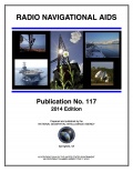
Radio Navigational Aids (Pub. 117) - National Geospatial-intelligence Agency [2014, PDF]
Author: National Geospatial-intelligence Agency |
CaptainWhite | 8027315 8 MB | 2 | |||||||
|
Sailing Directions / Лоции - National Geospatial-intelligence Agency [2014-2017, PDF]
Author: National Geospatial-intelligence Agency |
CaptainWhite | 330897803 316 MB | 6 | |||||||
|
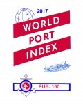
World Port Index 2017 (Pub. 150) - National Geospatial-Intelligence Agency [2017, PDF]
Author: NATIONAL GEOSPATIAL-INTELLIGENCE AGENCY |
CaptainWhite | 4503102 4 MB | 2 | |||||||
|
Текущее время: Сегодня 21:42 Часовой пояс: GMT + 3 |


